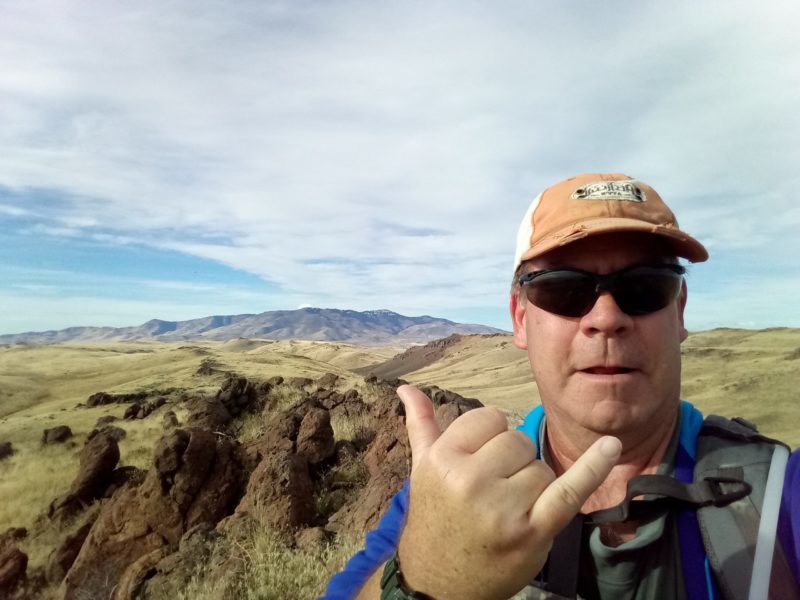
Life off Interstate 84 - Idaho

The BondyWeb in Mountain Home

  • Increase font size
  • Default font size
  • Decrease font size
 

Newsflash

Hire Bondy in Mountain Home Idaho

See my on-line resume and if you know of someone hiring, let them know about me.
http://bondyweb.com/tim-bondy-professional-resume
 

Idaho Photo's Revisited

Our Rock Hounding Idaho Crystal Finds
Aug 2011:
  See pictures from our last rock hound trip.  Click Here to see more photos.

You are here: Home

Mountain Home Idaho News and Adventures

Oolite Interpretive Site near Grand View Idaho

E-mail
Oolite? What the heck is that? It's not a new beer or some kind of new fad diet food. Read on to find out.

Owyhee Oolite Formation Site

The BLM has a “new” interpretive site south of Grand View on Mud Flat Road. This geologic information site is pretty cool and there is a walking trail on site also.

While hiking and enjoying the great Idaho outdoors, sometimes it's nice to actually understand the area to gain a better appreciation of what I'm seeing.

1. The Big Picture
How Idaho Oolite formed

What it says:
  • Extending across southwest Idaho between the Owyhee Mountains and Boise Front is the broad valley of the western Snake River Plain. Evidence indicates that the Plain began as a continental rift about 12 million years ago. Here, the earth's crust was pulled apart, northeast to southwest, and was stretched thin like taffy.
  • As crustal extension progressed between 11 and 9 million years ago, the Owyhee Mountains and the Boise Front responded by rising to their present height along faults bordering the rift. Now a valley, the Plain became a basin for Lake Idaho. Some 200 miles long and 35 miles wide, Lake Idaho drained south into Nevada.
  • Thousands of feet of sediment were deposited on the Lake's bottom over its 6.5 million years of existence, interrupted at times with layers of basalt and volcanic ash (tuff) from eruptions of adjacent volcanoes.
  • Geologist think that 2 to 4 million years ago, water from melting glaciers caused Lake Idaho to overflow to the west.. Captured by the Snake River, the waters drained out in a massive flood that gouged Hell's Canyon. The sediments left behind from Lake Idaho are known as the Chalk Hills and Glenns Ferry Formation.

2. Shoofly Oolite
Shoofly Oolite near Grand View Idaho

What it says:
  • The natural sculpture garden is a section of the Glenns Ferry Formation called the Shoofly Oolite. Oolite is sedimentary limestone composed of tiny ooids, which form when calcium carbonate precipitates in concentric layers around individual grains of sand. The Shoofly Oolite is one of the largest freshwater lakebed oolites known in the world.
  • Most other examples of ooid formation and deposition are found in wave-agitated sea waters or on the beds of much saltier lakes. Wave action that varied with the seasons, the weather, and the types of sediment in the water washed the ooids back and forth in the shallows on the southwestern side of Lake Idaho, depositing them from 2 to 40 feet thick on steeper benches near the shore.
  • Erosion carried away softer siltstone and volcanic tuffs but left the more resistant oolite to weather above the mudflats. Small, isolated deposits are exposed discontinuously across the 40 miles between this spot and Murphy. In some places, the upper surface of the oolite has been sculpted into hummocks, small arches, and intriguing shapes.
  • Beach sands of varying thickness underlie the oolite. Siltstone, deposited by lake waters, forms the stratum above it. Rivers and fans at the base of the adjacent mountain slopes later deposited a veneer of alluvium over the lake deposits.
  • The physical and chemical properties of the Shoofly Oolite provide the foundation for the unique set of plants and fossils found here. Few other lands in Idaho support such a rich suite of rare species in such a small area.


3. Vegetation of the Shoofly Oolite
Plants that grow in Idaho Oolite

The 5 Rare Plants in the Shoofly Oolite Formation

  • Mulford’s Vilkvetch (Astragalus mulfordiae)
  • Snake River Milkvetch (Astragalus purshii var. ophiogenes)
  • Packard’s Cowpie Buckwheat (Eriogonum shockleyi var. packardiae)
  • White-margined Wax Plant (Glyptopleura marginata)
  • White Eatonella (Eatonella nivea)

While the information on the sign indicated these plants are rare, in my experience only the White Eatonella seems to be the only “rare plant” in the Owyhee's. Your mileage may vary.

Coordinates for the BLM Oolite Interpretive Site on Mud Flat Road: 42.837189, -116.122149


Thanks,


tim-bondy-idaho-blogger


Last Updated on Saturday, 28 January 2012 08:58

Stalked on Kicking a Plott Hound Creek Hike

E-mail
Getting stalked on a hike in the Owyhee Wilderness is unnerving even if I never saw a thing. Read on for more about this hike.

Little Jacks Wilderness and Kicking Plott Hound Creek

(January 17th, 2012) This hike was located on the very edge of the The Little Jacks Creek Wilderness in the Owyhee's of Idaho just off Mud Flat Road. I had a longer hike planned but a few things got in the way. Even though it was a short hike, the scenery and solitude was outstanding.

The Kicking a Plott Hound Creek Hike
I parked at the Poison Creek Picnic Area on Mud Flat Road (42.756916, -116.297625) and my Plott Hound Addie and I headed southeast up an unnamed creek bed. My intended route was to take me up and around a minor peak before heading back to the car on the far side of the mountain. It wasn't an overly ambitious plan at around 3 miles.

The Cliffs of Kick Plott Hound Creek

Heading up the self named “Kicking a Plott Hound Creek” was interesting. There were some cool rocks...white rocks with spots of smoky quartz embedded in them. And the creek bed was rather rough and tumble with plenty of small cliffs to scramble up. I probable kicked my dog Addie about 20 times heading up these cliffs. One moment she was on top of the cliff and the next she was right on my heels where she'd get a boot to the nose. Addie the Plott Hound did not seem to mind though.

Rock Hounding Find off Mud Flat Road

On a higher saddle, the creek bed shallowed out as it wandered up to its source on the south side of my first destination peak. This is also where strong southerly winds started howling. Moving out of the creek bed we began our trek up the peak. It certainly did not look all that steep as I headed towards a lone pine tree near the top. But coming down the same area it felt pretty darn cliff-like.

I did not have the lungs nor the will to walk to the exposed peak. The lone pine was quite high enough and brutally cold in what I estimated to be steady 30 mph winds. The sweat I worked up on the uphill leg began chilling me to the bone. But the view from this high vantage point made the effort completely worth it.

Cliff seen from Lone Pine Peak

I was cold so I suspected my dog was rather chilly too. She doesn't have a very thick coat of fur so I got on the downwind side of the lone pine and sat in a small hollow in direct sunshine. Sure enough it was quite pleasant. Warm enough to take off my jacket and drink some water. I fed the dog some treats and a whole quart of water right there.

While enjoying the break, my ever vigilant dog locked on to something down in the valley we just came up. She stared long and hard down there and issued a series of low growls. Something I've never seen her do.

Valley where a mountain lion or wolf might have been stalking us

Stalked or Not Stalked - I'll Never Know
My plan was to head around to the south side of the mountain and head back to the car. The winds were ripping and I did not feel like dealing with it. Plus my dog was spooked about something in the general direction we came up. I wanted to know what it was, so we headed back down the way we came.

I'm not a complete idiot, so figuring my dog would be safer, we kept to the high ground. If it was something like a mountain lion or possibly a stray wolf, at least I might spot the creature by staying high. So we cross-sloped along the side of the peak. And my dog stayed higher than me...obviously still somewhat spooked.

I never saw a darn thing all the way back to the car. And I looked! That doesn't mean whatever was down there didn't see us. But who know, it could have been a badger that spooked Addie.

GPS Track Map of this Owyhee Wilderness Hike

View Larger Map

Hike Stats:
Total Hiking Mileage: 1.75
Elevation Gain/Loss: 719 feet
Average Slope: 14.7% and my thighs are telling me it might have been even steeper.
Road Mileage from Mountain Home: 44.3 miles
Link to More Pictures: https://picasaweb.google.com/tim.bondy/KickingPlottHoundCreekHike?authuser=0&feat=directlink

The Land We Hiked
All land on this hike was part of the Little Jacks Creek Wilderness established in 2009. I don't know when the “wilderness rules” went into effect for this area, but I suspect cattle grazing isn't an acceptable practice here. I'm also not a “scatologist”, but the numerous cow patties I encountered appeared to be “not so old”.

From Kicking Plott Hound Creek Hike

Overall, the land appeared to be fairly healthy but cheat grass was quite abundant in places. While I have mixed emotions on creating more wilderness in Idaho, I figured the Owyhee Wilderness would give me a cow patty free place to hike. As you can see, this wasn't the case. Hopefully in the coming years, this geologically interesting wilderness will eventually return to a more natural state. There's plenty of land in the Owyhees to accommodate hikers and ranching.

The “Call to Action” Section
My call to action is to leave a comment and or question. Gotta be people out there who want more or who could use an answer to a question about this area. Got some answers? I asked a few question in this article...let's hear from you too.

Thanks,


tim-signature


Last Updated on Friday, 20 January 2012 08:38

Fort Boise? Can they all be Evil?

E-mail
They are evil. They are stupid. They are corrupt. They are not worthy. Or is the author blind with abnormal hate?

fort boise website is for the haters

The Fort Boise website is a left leaning personal blog out of Boise, Idaho. The author of this blog spends an inordinate amount of time trying to prove all conservatives and/or Republicans are lower than pond scum. My opinion? Blind with hate and doesn't have an iota of critical thinking ability left in his/her body. Basically Fort Boise is the Rush Limbaugh of the Boise Democratic Party.

Why Do I read the Fort Boise Blog?
I read many political blogs. It's good to see how each issue is handled by people of different (or the same) political persuasions. It's a good learning experience in that I get to see the important issues from all sides. Sides I might not have considered otherwise. But with the Republican Presidential nomination season in full swing, Fort Boise has been getting worse.

Some days I get a laugh out of the author's musings. Other days I get annoyed. But one thing is for sure. The Fort Boise author couldn't find one good thing to say about a Republican. I suspect that if Gandhi, Buddha and Mother Teresa were running for the GOP nomination, they too would be vilified, degraded and dismissed completely.

Give the Fort Boise Blog a Try
I recommend that everyone in the U.S. give Fort Boise a test drive. Read it daily for a week or 2 just to get a feel for the hate and uncommon sense the author spits out. Just like Rush Limbaugh, Fort Boise can change your mind on almost any political issue. I read what Fort Boise “thinks” and know being on the other side it the right thing to do.

Here is the link: http://fortboise.org/blog/

Comments?
Let me know what you think about the hater known as Fort Boise. If you think I'm wrong, let me know. I'm reasonable and will listen to your ideas as long as they aren't taken to the extreme.

Thanks,


tim-bondy-idaho-blogger
Last Updated on Wednesday, 18 January 2012 08:59

Canyon Creek Near CJ Strike Reservoir

E-mail
Want to take a nice hike near a relatively unknown canyon less than 30 miles outside of Mountain Home, Idaho. Hiking boots required! See why.

No sign of Canyon Creek from the parking area

(January 12th, 2012) This hike along the lower portions of Canyon Creek has been a long time coming. I discovered this area on Google Earth a few years ago but my interest waned thinking cattle grazing and private property would make exploring less than enjoyable or even impossible. But neither issue got in the way. My original idea was to hike in the canyon itself but I'm glad I decided to take the lazy route instead.

Lower “Canyon Creek” Hike
This hike starts just off the Strike Dam Cut-Off Road. From where I parked, I saw no signs of a canyon as I gazed over the amber waves of grass to the east. I jumped the fence and headed cross-country with my dog leading the way. It wasn't long before I was on a low bluff overlooking the Canyon Creek canyon.

Beginnins of lower Canyon Creek canyon

Once in this shallow and very dry river valley we headed south towards CJ Strike Reservoir. Things started getting a little more interesting pretty fast. The lower or southern part of Canyon Creek carves out a gradually deepening canyon until it reaches CJ Strike. The beginning of the canyon is rather narrow and choked with old tumbleweeds and large boulders.

My plan was to hike “inside the canyon” for a while before heading back to the car. I changed my mind when I saw just how rough and tumble the hike inside the canyon would be...at least initially. So I continued south along the western side of the canyon rim thinking I might eventually find a way down. That chance never came as the canyon got deeper and the sheer cliffs made a scramble down impossible.

From Canyon Creek Near CJ Strike Reservoir


I was content to just take a nice walk along the canyon rim as this wasn't planned to be more than a short easy exploration. But the longer I walked, the cooler the scenery got and the deeper the canyon became. So I continued heading south for a while. Actually I did a stupid thing by hiking outside the planned route I left with my wife. But being outside the canyon, I felt the chances of anything bad happening to me was remote.

Overall, this was a pretty darn cool hike. The views into Canyon Creek were outstanding. I did not actually think it would be quite as deep and dramatic as it was. I'd still love to get inside that canyon but it will take a little more planning, maybe some rope and a hiking stick. The rope would be “just in case”. I would classify this hike as an “easy to moderate hike” only because the off-trail aspect.

I believe the main reason this hike stayed in my hiking queue was the fact that I have done some exploration of Canyon Creek where it comes out of the Danskin Mountains near Mountain Home, Idaho. Who knew Canyon Creek becomes such a formidable canyon just 2 miles before the Snake River?

GSP Track of Lower Canyon Creek Hike

View Larger Map


The Stats on Hiking Canyon Creek near CJ Strike Dam
Mileage of Hike: 2.17 miles
Average Slope of Hike: about 6%
Elevation Gain/Loss: 367 feet
Mileage from Mountain Home: 20.3 road miles with about 2.5 miles on the cushy Strike Dam Cut-Off Road.
Link to Some More Pictures:  https://picasaweb.google.com/tim.bondy/CanyonCreekNearCJStrikeReservoir?authuser=0&feat=directlink

Heath of the Land Along This Hike
As far as I can figure, my hike was done entirely on BLM lands. Most BLM lands are heavily grazed but this area seems to be the exception. While I walked past some cow patties, this area was about as clean as it gets in southern Idaho. But the primary ground cover is cheatgrass and most dog owners know this stuff isn't good for them.

The Tumbleweed Road Block in Canyon Creek near CJ Strike Reservoir

Trash and signs of human activity were almost non-existent. I did see a few recent tire tracks and an old tire down in the canyon itself. Not exactly sure how a truck got down into this area but it had to take some determination and skillful driving.

Comments
Hope you enjoyed this article. Please feel free to leave a comment or question for me.


Thanks,


tim-signature

Last Updated on Saturday, 14 January 2012 21:47

Page 8 of 92

Dedicated Cloud Hosting for your business with Joomla ready to go. Launch your online home with CloudAccess.net.